The Maryland Historical Trust Library is open to historic preservation consultants on Tuesdays, Wednesdays, and
Thursdays by appointment only. Please read the information below before scheduling your visit. For
further information or to schedule an appointment, contact Lara Westwood by email
at lara.westwood@maryland.gov or by phone at (410) 697-9546.
All material relating to Maryland's archaeological sites is accessible only to qualified researchers with a
valid Medusa account (see below). If you need access to this material, and you do not already have a valid
Medusa account, please be sure to allow sufficient time for your account request to be processed.
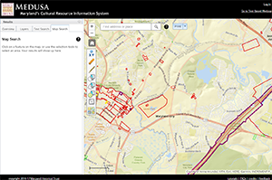
 Click on image to open Medusa.
Medusa, Maryland's Cultural Resource Information System
Through Medusa, you may access information about architectural and archaeological resources recorded in
the Maryland Inventory of Historic Properties (MIHP) and the National Register of Historic
Places (NRHP), as well as properties on which MHT holds preservation easements. Medusa also
includes information on resources that have been evaluated for National Register
eligibility (Determinations of Eligibility - DOEs).
User accounts are required for access to archaeological site data; they are not required for access to architectural records.
Full User Accounts. If you meet the
Secretary of the Interior's Professional Qualification Standards for Archeology, you can obtain a "full" account that allows you
off-site (remote) as well as in-Library access to the archaeological data. Please allow up to two weeks for processing your request.
Proxy Accounts. An archaeologist with a valid Medusa account can also request one or more "proxy" accounts
for individual co-workers or students who need access to the archaeological database for compliance or research
projects. Typically proxies are people who work for contract firms or who are students working under a professor's
guidance, and who may not meet the Secretary's Standards on their own.
» Submit Account Request
For More Information About Requesting an Account. Please contact Gregory Brown at 410-697-9538
or gregory.brown@maryland.gov.
Architectural Material
Maryland Inventory of Historic Properties (Architecture)
Documentation for the architectural properties on the Maryland Inventory of Historic Properties is maintained for
approximately 40,000 architectural resources (individual sites and historic districts). It is suggested that this
material be searched using Medusa, Maryland’s Cultural Resource Information System. Several workstations
are available in the Library to access this material. You can also view this information off-site
at https://apps.mht.maryland.gov/medusa,
although you may still need to schedule a visit to view the paper forms, any associated resource reports,
and maps of resource locations.
The Architectural Survey Files are kept in binders by MIHP number, and include the full set
of data submitted for any particular property. These typically include summary descriptions of the resource, a
statement of significance, maps, photographs, negatives, and sometimes drawings. Scanned PDFs of most resources
are linked through Medusa, though users should be aware that any recent additions to the paper files may or
may not be included in the scanned PDF; the date on which the document was scanned is included on the Medusa record.
GIS Maps are available for MIHP properties on the Library computers using
the Medusa Cultural Resource Information System. Available layers include not only the MIHP, but also National Register
properties, "short DOE" (determination of NR eligibility) records, and locations of sites in the MHT Easement program.
Paper USGS quad maps with marked property locations are also available in the Library.
Architectural Reports are stored in the MHT Library; these include historic structures reports,
survey reports, and other more extensive documentation of particular properties. Requests for copying will be
granted on an as-needed basis and based on the condition of the material. There is a copying fee.
Archaeological Material
Maryland Inventory of Historic Properties (Archaeology) Site Forms
Documentation for the approximately 13,000 archaeological properties on the Maryland Inventory of Historic Properties is maintained at
the MHT. Again, it is suggested that this material be searched using Medusa, Maryland’s Cultural Resource
Information System. Several workstations are available in the Library to access this material.
Note that you will need a valid Medusa account to access this material.
» MHT Site Location Access Policy
"Full" (non-proxy) Medusa account holders can also view this information
off-site at https://apps.mht.maryland.gov/medusa,
although you will still need to schedule a visit to view the paper forms, any associated resource reports, and maps
of resource location. You may also find useful the MHT Archaeological Synthesis
Project (https://mht.maryland.gov/Pages/archaeology/archaeology-synthesis.aspx).
Archaeological Survey Files currently include site-specific survey reports, maps, slides, and
documentation for over 13,000 terrestrial and underwater archaeological sites ranging from shipwrecks, wharves,
piers, aircraft, historic domestic sites, cemeteries, slave quarters, mills, shell middens, and
prehistoric villages and camps.
GIS Maps are available for archaeological sites on the Library computers using
the Medusa Cultural Resource Information System. Available layers include not only archaeological sites, but also Phase I survey boundaries and
quad files. Physical USGS quad maps with marked property locations are also available in the Library.
Archaeology Survey Reports and other more extensive documentation of particular sites are stored in
the MHT Library. Copying of these materials is restricted, and responses to requests are decided based on
individual situations. There is a fee.
Things to Remember Before Your Visit
Please remember your Medusa password if you are accessing archaeological information (you will need it to log on at
the Library), and bring a flash drive or something to store your data. Also, you must have your project location clearly
marked on a USGS topographic map (not an aerial view).