The Maryland Historical Trust (MHT) maintains a geographic information system (GIS) and related database on
Maryland’s architectural, archaeological, and cultural resources.
The system is designed to facilitate MHT staff responsibilities in the areas of research, review and
compliance. Currently, the information is available to researchers at workstations in the library.
GIS data is also distributed on disk to consultants, government agencies, and non-profit organizations for
planning and research purposes. The data is also incorporated into Medusa, the State's online cultural
resource information system.
MHT has been developing GIS data on historic properties since 1991. The primary system data
consist of the National Register of Historic Places, state inventories of historic properties and archaeological sites,
the statewide record of archaeological survey coverage, and MHT Historic Preservation Easement holdings. MHT also
develops and maintains the Maryland Heritage Area boundary files.
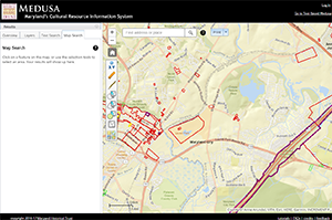
 Click on image to open Medusa.
Medusa, Maryland's Cultural Resource Information System
Through Medusa, you may access information about architectural and archaeological resources recorded in
the Maryland Inventory of Historic Properties (MIHP) and the National Register of Historic
Places (NRHP), as well as properties on which MHT holds preservation easements. Medusa also
includes information on resources that have been evaluated for National Register
eligibility (Determinations of Eligibility - DOEs).
User accounts are required for access to archaeological site data; they are not required for access to architectural records.
Full User Accounts. If you meet the
Secretary of the Interior's Professional Qualification Standards for Archeology, you can obtain a "full" account that allows you
off-site (remote) as well as in-Library access to the archaeological data. Please allow up to two weeks for processing your request.
Proxy Accounts. An archaeologist with a valid Medusa account can also request one or more "proxy" accounts
for individual co-workers or students who need access to the archaeological database for compliance or research
projects. Typically proxies are people who work for contract firms or who are students working under a professor's
guidance, and who may not meet the Secretary's Standards on their own.
» Submit Account Request
For More Information About Requesting an Account. Please contact Gregory Brown at 410-697-9538
or [email protected].
Visiting the MHT Library to Use GIS Data
The library is open to the public on Tuesdays, Wednesdays, and Thursdays by appointment only. All
material relating to Maryland's archaeological sites is accessible only to qualified researchers with prior
approval from the Office of Archaeology. For further information or to schedule an appointment, contact
Lara Westwood by email at [email protected], or by phone at (410) 697-9546.
Obtaining Data Products
GIS data are available to outside users for research and planning purposes, provided in shapefile format on CDs.
Fees cover the cost of producing the files and transferring them to CD. Use the
order form/license agreement
to order data.
Three historic sites GIS data sets are commonly distributed:
- National Register of Historic Properties
- This data layer depicts boundaries of historic properties in Maryland that are listed on the National Register
of Historic Places, a listing maintained by the U.S. Department of the Interior.
- Maryland Historical Trust Historic Preservation Easements
- This data layer depicts properties where owners have entered into an easement agreement with MHT to
protect the historic character of the property.
- Maryland Inventory of Historic Properties
- This data layer depicts all historic properties which have been listed on the state inventory.
Each set consists of a digital file of the property locations and a database table which contains identification
and attribute information. See order form for pricing.
Maryland Inventory of Historic Properties (Archaeology) Sites
Because of the sensitivity of archaeological site information, access to archaeological site
location data is restricted and is generally available only to those who meet the Secretary of the Interior's
Professional Qualification
Standards. Qualified individuals who wish to obtain this data layer should
contact Jen Chadwick-Moore by email at [email protected]
or by phone at 410-697-9539.
On-Line GIS Data
As part of Maryland's open data policy, MHT's GIS data (excluding archaeological site locations) is
also available through the Maryland Integrated
Map (MD iMap), Maryland's mapping and GIS data portal. The data available online includes NRHP, MIHP,
MHT Preservation Easements, and Maryland Heritage Areas. Data online does not include Determination of Eligibility information or
archaeological site information.
Online metadata and version info is found in the Map Service information on MD iMap.
Map Service Links
National Register of Historic Places:
http://geodata.md.gov/imap/rest/services/Historic/MD_NationalRegisterHistoricPlaces/MapServer
Maryland Inventory of Historic Properties:
http://geodata.md.gov/imap/rest/services/Historic/MD_InventoryHistoricProperties/MapServer
Maryland Historic Trust Preservation Easements:
http://geodata.md.gov/imap/rest/services/Historic/MD_MHTPreservationEasements/MapServer